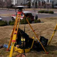
MCN uses the most advanced GIS software, to map out the most cost effective route for your communication needs. By using the GIS system MCN insures you will always have a set of maps BEFORE we start installing your lines; so that repairs on problems, that may occur, in your lines, will be hassle free. This ensures that your communication needs will not be delayed any longer than possible. MCN also uses these GIS maps for proper documentation on the job to ensure that, each step of the way everything is level, in order for the equipment and service to operate at the highest of quality possible. When it comes to adding future lines, if needed the GIS maps previously made, also allow the team at MCN to know where the current lines are so that we do not interrupt existing service for your valued customers. The GIS also helps the teams at MCN to calculate the emergency response times in the event of a natural disaster. We use Trimble gear to stay on top of the latest technology and give the best results that can be given. MCN uses some of the top software out there for GIS surveying and tower placements.
Showing where your cable is, where and how far your towers are placed, or even just for quoting purposes so that we can give you the best options for your dollar.